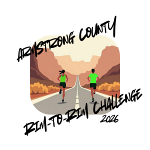
Armstrong County Rim-to-Rim 15K Challenge
Sat, Jun 27, 2026, 3:00 AM CDT
- Type
- Run
Sign up and verify details on the organizer's official page.
Race feel
Conquer a challenging 15K point-to-point road run with an 800ft climb out of the scenic Palo Duro Canyon.
- Scenic
- Competitive
Embrace the Armstrong County Rim-to-Rim 15K Challenge, a demanding road run through the stunning Palo Duro Canyon. This point-to-point race offers a unique journey, beginning with a significant downhill stretch, transitioning to rolling hills within the canyon, and concluding with a challenging 800-foot climb out. It's an opportunity to test your endurance amidst striking natural beauty, perfect for runners seeking a memorable and rigorous experience in the Texas landscape.
What to expect
- Experience a point-to-point 15K road race with significant elevation changes.
- Begin with a mostly downhill section, followed by rolling hills inside the canyon.
- Conclude with a challenging 800-foot climb to the finish, with relay options available.
Standout details
- Challenging 15K road run
- Through Palo Duro Canyon
- 800ft elevation change
- Point-to-point course
Course feel
A practical read on terrain, elevation, footing, and typical conditions.
Big Test
Typical course trends
- Typically rolling
- Mostly paved footing
Distances & registration
2 optionsUse the official signup link above for all distances.
15K
2 options · closes Jun 26, 2026, 7:59 PM CDT
1mo 27d 18m leftIndividual 15K Challenge
Closes Jun 26, 2026, 7:59 PM CDT · From $54.00
3 Person Relay
Closes Jun 26, 2026, 7:59 PM CDT · From $128.20
Built from public event details. Confirm schedule, fees, and rules on the official event page before signing up.
From the organizer
Challenging 15K road run through the Palo Duro Canyon south of Claude, Texas.
Starting line: 14 miles south of Claude, Texas on Highway 207. Please note this is a point-to-point race. We encourage you to arrange your own transportation back to the starting line. There will be very limited transportation for runners from the finish line back to the starting line so be prepared to wait.
Finish line: 9 miles (15K) south of the starting line. Course has approximately 5 miles of mostly downhill with about 800ft elevation change. Followed by about 2 miles of rolling hills in the bottom of the canyon. You complete the race climbing the 800ft out of the canyon. Check out our facebook page for pictures of the course along with directions.
Relay Handoff: Handoff #1 will be at about 3.1 miles and handoff #2 will be at about 6.2 miles.
Starting line: https://maps.app.goo.gl/5gK1NpEqVKm8HwHN9
Finish line: https://maps.app.goo.gl/nmpe1dwVkZZyqAwq8